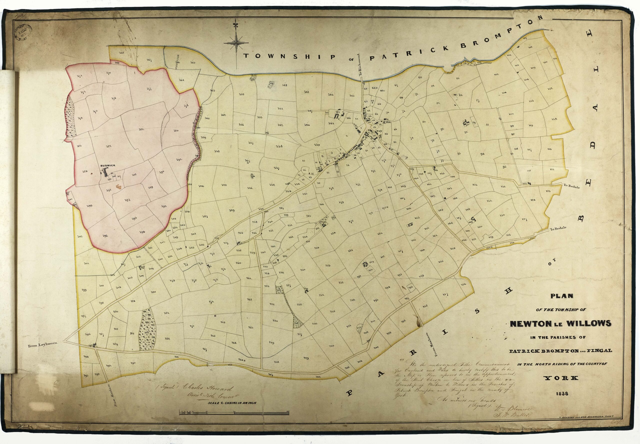
Traditionally, tithes were a compulsory payment of one tenth of the produce of land or labour, collected to support the local church and clergy. After the Reformation, and the dissolution of the monasteries under Henry VIII, much of the church’s land passed to private owners, known as lay impropriators, who also gained the right to collect the tithes.
Tithe owners were often seen as unfairly benefiting from the increased crop produce arising from improvements made by those who paid tithes. By the early 19th century, factors such as industrialisation, religious disagreements and a struggling agriculture made tithe payments unpopular, leading to disputes over how they were assessed and collected.
The Tithe Commutation Act of 1836 replaced the payment of tithes in goods with a money payment, based on the value of the land and price of corn. Tithe Commissioners were appointed to survey, value and record information to determine which lands were subject to tithes, who owned them, how much was owed and to whom.
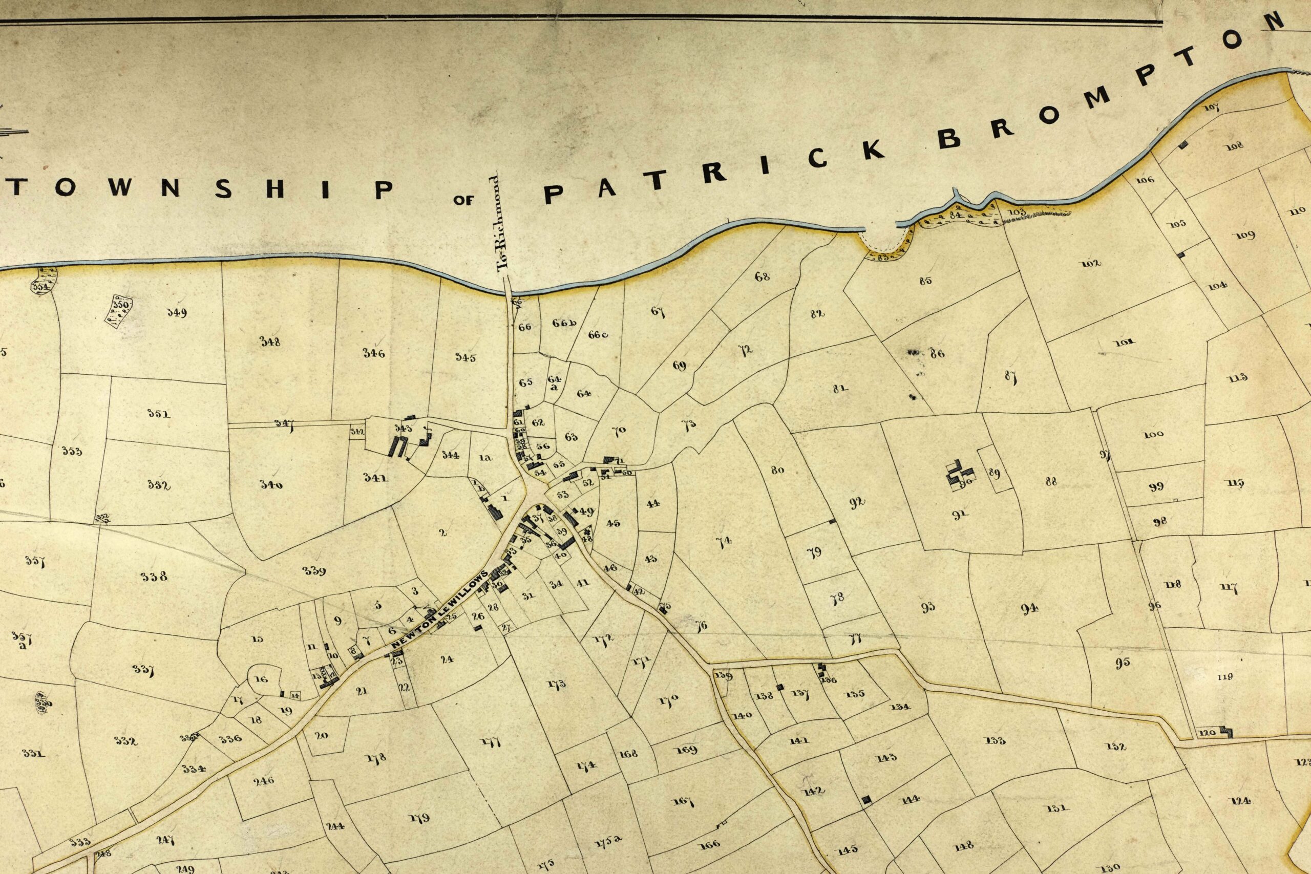
Detailed maps were created to show every piece of land subject to tithes, often covering the entire parish or township. These maps were linked to an ‘apportionment’ that recorded the name of the landowner, the occupier, the land size in acres, a field name, the state of cultivation and its value.
Image: Tithe map of Newton le Willows, Richmond and Dales, 1838.
The process of surveying and recording continued for over 15 years. The earliest tithe maps and apportionments date from 1837, with most drawn up in the 1840s, and the final few completed in the early 1850s.
The information value of these hugely important documents was immediately recognised by researchers and they remain an amazing resource for all kinds of local, building and family history studies.
Understanding a tithe apportionment
Tithe apportionments are the written document that accompany the tithe map. The layout of the apportionment follows a set form with the entries ordered alphabetically by the surname of the landowner. The occupiers of each plot are then listed, but may on occasion appear at multiple places within the apportionment if they occupy a number of plots, owned by different landowners.

Image: Apportionment for Newton le Willows, Richmond and Dales, 1838.
Each plot has a number to relate to the map; many plots will have a name or description and some will have a state of cultivation, usually indicating if the land is meadow, arable or pasture. The size of the plot is listed in acres, roods and perches (40 perches = 1 rood, 4 roods = 1 acre).
Some plots are described as Glebe land, which indicates that the plot belongs to a Church appointment such as a vicar or rector. They were able to farm the plot themselves or rent it out to generate a small income.
The apportionments for larger places will sometimes be broken down into smaller sections to list the plots in villages or townships separately, but this will be indicated on the map page.
Availability of North Yorkshire tithe maps not on the website
If you have searched the website but have not been able to locate the map for your area there are a number of possible reasons why.
As we are gradually updating this website, please check our list of tithe maps uploaded so far. To confirm if we hold the tithe map you’re looking for, please see our Guide 3 titled Maps and Plans found on our online catalogue homepage.
As some parts of current day North Yorkshire were formerly within the West Riding of Yorkshire, some tithe maps for North Yorkshire places may be held by the West Yorkshire Archive Service. For a list please see their Collections Guide 9 titled Tithe.
The Borthwick Institute for Archives also holds tithe maps within their collections, for a list please see their guide Tithe Awards and Maps.
Three copies of each tithe map were produced. Two copies were created for the church authorities, known as the diocesan copy and the parish copy. The Tithe Commissioners’ copy is held by The National Archives.
Unfortunately, not all copies of tithe maps and apportionments survive. In some cases, we may hold a copy of the map without the apportionment or the apportionment without the map.
If an area had undergone the process of enclosure, it is likely that at this time the tithes would have been commuted so a tithe map and apportionment may not have been created.
In some areas a tithe map and apportionment may not have been made if the amount involved was negligible, a special award had been made, or if the landowner was also the tithe-owner. For a more detailed explanation of tithes, please see the guide from The National Archives.


